YOSEMITE — The South Fork Fire is creating very smoky conditions on the southern end of Yosemite National Park and continues to threaten the community of Wawona.
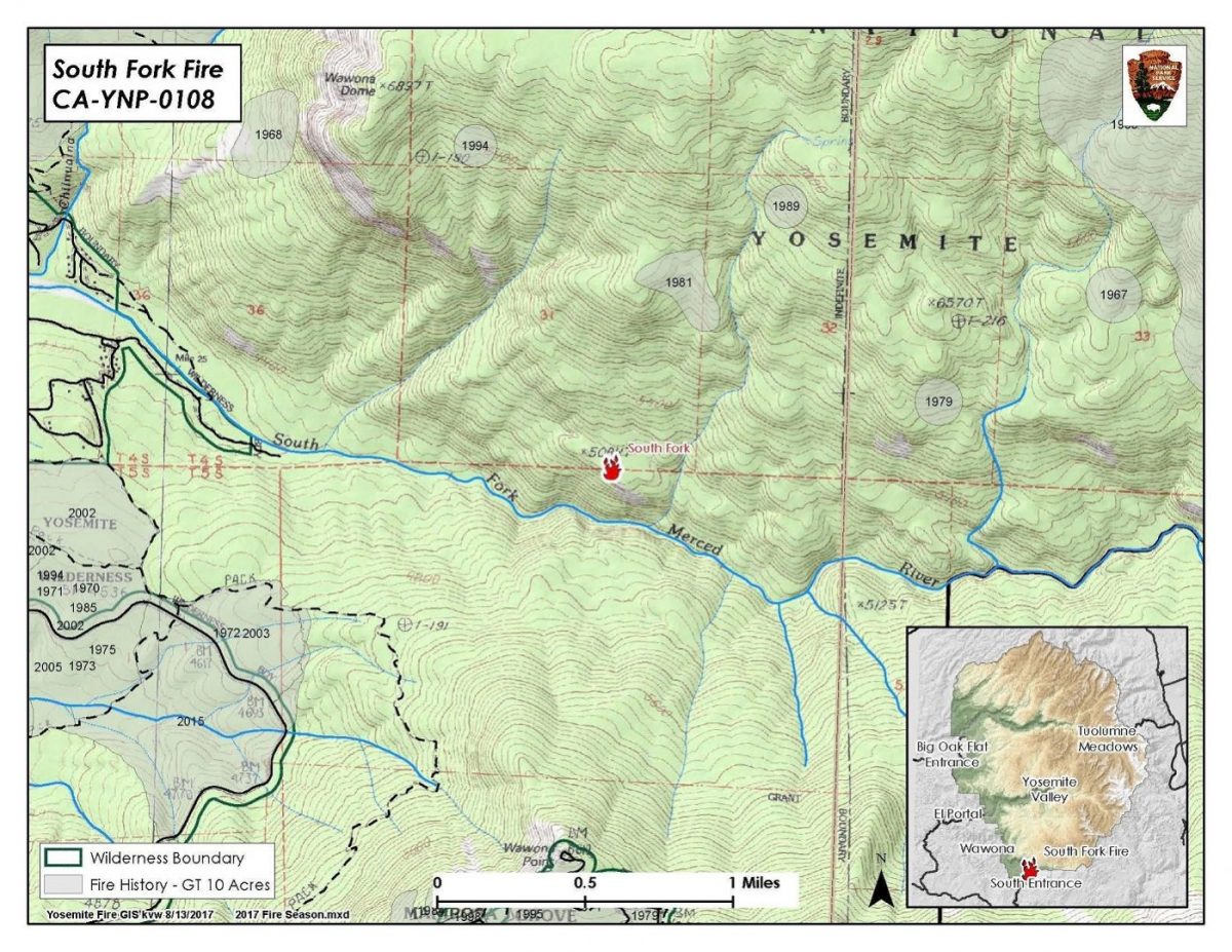
The fire is still estimated at 400 acres with 0 percent containment.
Today, firefighters will continue to aggressively suppress the spread of the fire toward the community of Wawona on west flank, and use natural barriers to tie in firelines.
The South Fork Fire was reported just after 2 p.m. on Sunday, Aug. 13, and by 8 p.m. it had grown to 400 acres.
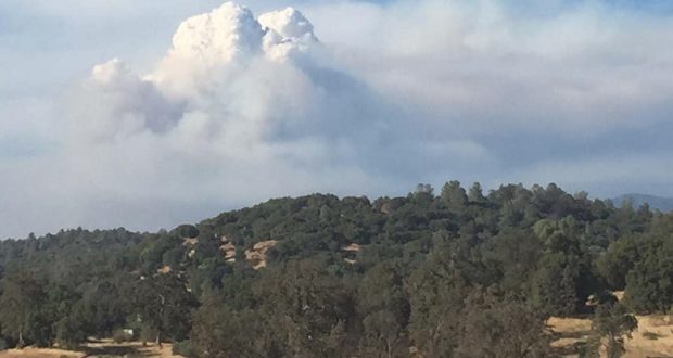
South Fork Fire from Fish Camp – photo by Mark Spencer
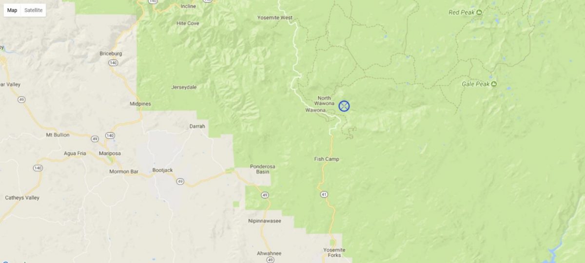
It is burning on the South Fork of the Merced River drainage, south of Wawona Dome approximately one mile east of the Swinging Bridge.
Last evening at about 7 p.m., residents and visitors in the Wawona area were warned to make appropriate pre-evacuation preparations.
If there is an actual need for evacuation, there will be door-to-door notifications by park staff.
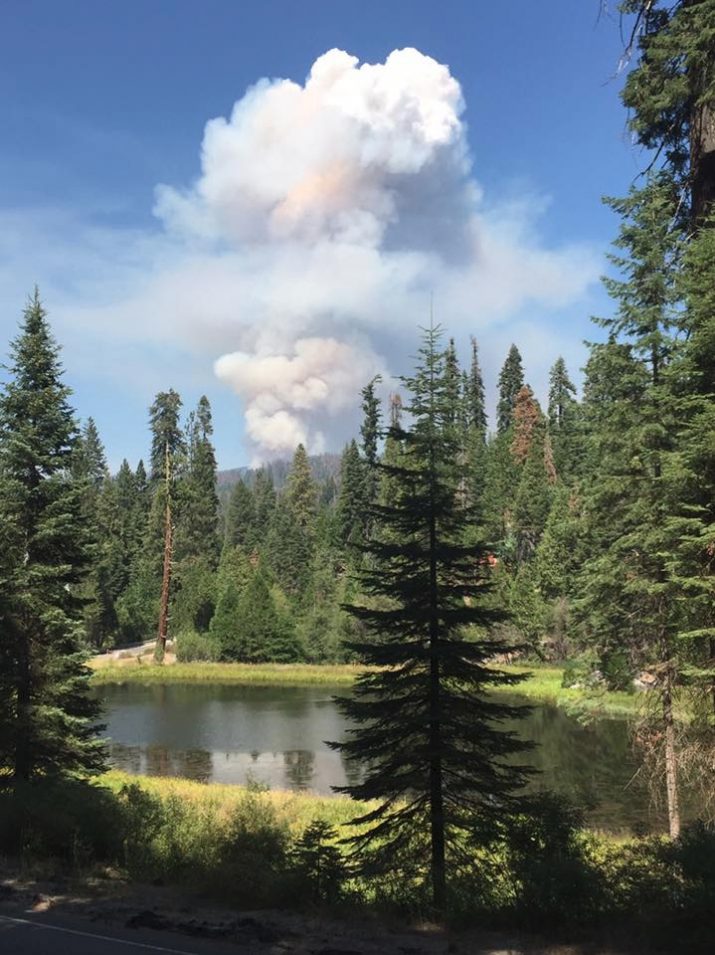
Heavy smoke is impacting the areas surrounding Yosemite, especially overnight and through the morning hours, adding more smoke to what is being produced by the Empire Fire near Bridalveil Campground, which is now estimated at 1,200 acres.
Air quality in Wawona is expected to be extremely smoky and to reach unhealthy/hazardous conditions through noon today.
Smoke from the South Fork Fire is expected to fill the canyons west of Wawona to Mariposa. It is also expected to affect visibility along Highway 140 from El Portal to Mariposa, Wawona Road south to Fish Camp, and roads along Tioga Pass to the Mono Lake area.
Recommendations:
– Close windows and doors to keep smoke out.
– Consider leaving the area if you have the option.
The fire is burning in a rugged wilderness area, and the cause is under investigation.
We will update as new information becomes available.
Click here for an interactive map.