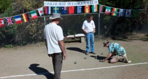
Editor’s Note: Longtime Oakhurst resident Bob Kaspar continues his epic ride across the United States from California to his hometown in Massachusetts. We lost track of Bob for a week or so. Now we know why. He’s been busy.
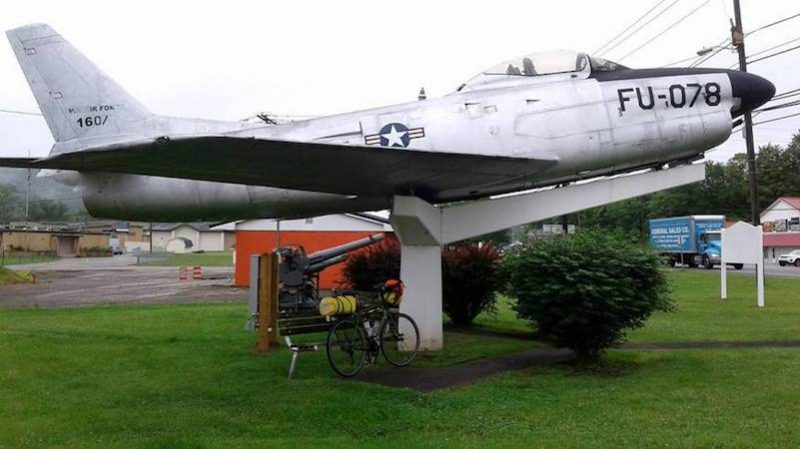
Out of the rain and under the protective wing of the USAF.
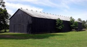 The Kentucky countryside is dotted with stately old tobacco barns.
They are all painted flat black and many have been re-purposed to other uses. Pasture fencing is also typically flat black — flat black was the cheapest paint available. It’s a nice effect.
From Lexington, Kentucky the route trends slightly northeast and into Appalachia. Economically depressed, West Virginia has the highest rate of opiate-related deaths in the U.S.
In Huntington, West Virginia, I left the bike at a shop to replace some parts and mentioned that I was going to McDonald’s down the street for lunch. I was cautioned against this, as it was located next to three methadone clinics. “Pods,” as they are referred to locally, of small groups of the addicted and homeless roam the streets. The economy is improving but for most that just means they can buy more or better drugs.
 In Charleston W. Virginia I stayed with experienced cyclist James Thibeault and his wife Karen in their lovely home on the Kanawha River. James came to Appalachia from Boston as a Vista Program volunteer in the 1960s and, like many, stayed.
He explained Appalachia to me in terms of cultural isolation due to the density of the forests, ruggedness of the terrain and the resultant difficulty of travel.
It was literally possible to live your entire life isolated from people only several miles away in the next “Hollow” (valley). West Virginia is the only state that lies entirely within Appalachia.
Beyond West Virginia, I make an acrobatic entrance into Virginia. Then turning northward, I travel through the beautiful and historically rich Shenandoah Valley to Harper’s Ferry and Gettysburg.
Face First into Virginia.
There’s about a ten mile stretch of highway on the West Virginia – Virginia border that’s off limits to bikes and a backroads detour must be fashioned. I was cruising along this route at about 6 a.m. when set upon by two dogs.
I was moving along pretty well but was in high gear, so it was hard to accelerate quickly and they began nipping at my legs. As I was kicking away the dog on my right, I didn’t notice that I was veering left. Upon looking up the last thing I saw clearly was the edge of a four foot ditch. I think the last thing I said was …”uh.”
I went into the ditch: the bike cartwheeled and I launched over the handlebars to land head first in the mud. Slightly dazed, I pulled my head out of the mud. The dogs milled about.
I sat there and looked at them and looked for some large rock I could pet them with. There was only mud, and I didn’t want to appear comical by trying to kill them with mud balls.
I saw the house a couple of hundred yards away where they came from, picked myself up and, if unsteadily, headed for it. To make matters worse, the dogs now trotted along at safe distance behind me like they were my best friends. I did the “serious knock” on the door and after a few minutes a voice emitted from behind. The exchange went something like this:
Voice: “What is it?”
Me: “Are those your dogs?”
Voice: “Maybe.”
Me: “Your _____dogs just ran me off the ____ road”.
Voice: “There’s no leash law in Allegheny County.”
Me: “Good, that’s why I’m not on a leash. So lets call the police or better yet, kill the dogs.”
Voice: “They were just doing what they do naturally.”
Me: “No problem then, me too. Call them over here.”
The door now opened and revealed an older man and woman who saw me covered in mud.
Voice: “Oh, we are so sorry why don’t you sit down. “
Me: “Thanks, but I can’t kill your dogs when I’m sitting down. “
Man: “I’ll go get your bike and then we’ll fix you some breakfast. “
Now this was a problem, because they appeared to be decent, albeit clueless people, and this made being as indecent to them as I wanted to be more difficult.
So we went back and pulled the bike out of the mud. Amazingly, the front forks and wheel were undamaged, possibly because the mud softened the impact. The visor had broken off the helmet and I was pretty well covered in mud but otherwise I appeared to be okay. So I left it at that.
A couple days later my neck stiffened up, but it appears to be getting better. I learned from this that it’s a mistake to engage in a running battle with dogs. Better to stop and let them mill about while you take out your slingshot and lead weights.
Dogs, sheesh. I love my little Beagle, Trumpet, but he would chase every cyclist if I let him. Anyway, I guess my first view of the Virginia countryside was pretty close up. This is the only time I wished I had one of those dopey video cameras that fasten to your helmet.
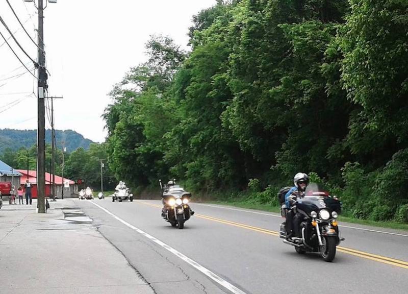 Soon after leaving Charleston people began lining the roads and overpasses and cheered and waved flags as I passed by. I waved back in grateful acknowledgment and faux humility. After several miles of this I heard a rumble from behind and moved over so that hundreds of motorcycles of the annual Memorial Day “Rolling Thunder” ride to the Vietnam War Memorial could pass by.

Memorial Day in West Virginia. It seemed like every marker stone, in every cemetery, had flowers.

A common scene in the Appalachians.
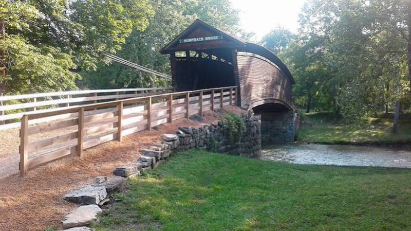
Humpback Bridge near Covington, Virginia. A lovely and unusual arched covered bridge built in 1857.

Adorableness Toby-Ann (right) and her sister at the Dairy Queen in Clifton Forge, Virginia. Toby took an interest in my trip and gave me $5. I bought a chili dog and a Pepsi.
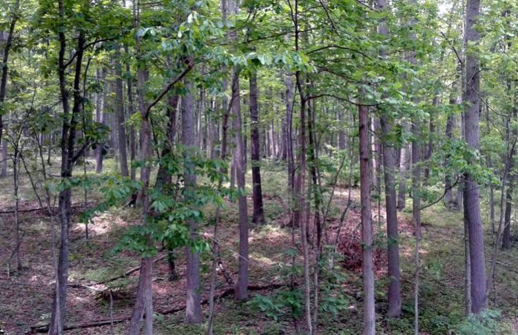
The eastern deciduous forest.
This temperate ecosystem is characterized by the seasonal appearance and disappearance of the canopy. Plant species that grow on the forest floor have only a short time in the spring to bloom before the main canopy shades out the sun.
These species are known as spring ephemerals and they were in abundance as I passed through.
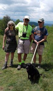 I worked with my friends Mark and Betty Gatewood in Yosemite in the mid 70s and hadn’t seen or spoken with them in 35 years.
It was really great to be able to spend a day hiking with them in the Blue Ridge Mountains. They are heavily involved in maintaining a 200-mile long section of the Appalachian Trail. Also, it was Mark’s birthday. I got him a slingshot.
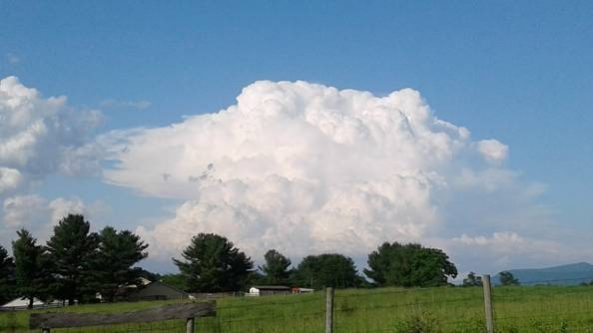
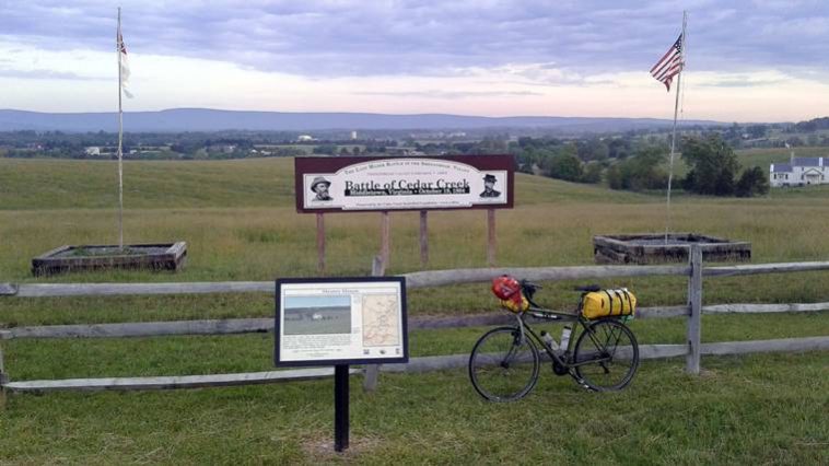
A massive thunderhead builds over the Shenandoah Valley. The Civil War is still being fought here. I saw more than one bumper sticker that said: “Virginia. Fighting Terrorism Since 1861.”
The economically important Shenandoah Valley was fought over for most of the Civil War culminating in the decisive Battle of Cedar Creek in October of 1864 which saw the area fall under Union control for the remainder of the war. The area is covered with memorials. By the time I arrived at Winchester, at the north end of the valley, I was absolutely soaked in history. I literally had to wring Stonewall Jackson out of my shirt.
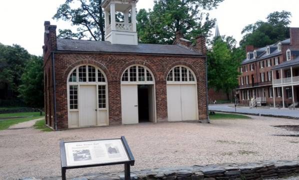 “John Brown’s Fort” at Harper’s Ferry, West Virginia.
John Brown was an abolitionist who believed that the institution of slavery could only be ended by armed insurrection.
In July 1859, two years before the outbreak of the Civil War, he led a raid on the Federal Armory at Harper’s with the intention of seizing weapons to supply the insurrection. A detachment of Marines, led by then-Union Col. Robert E. Lee, trapped John Brown in this building where he was then captured. Several months later he was hanged.
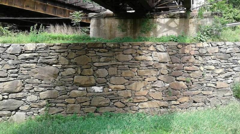
A beautiful section of dry stone wall on the old Chesapeake and Ohio Canal near Harper’s Ferry. The 185 mile long canal operated between 1831 and 1924.
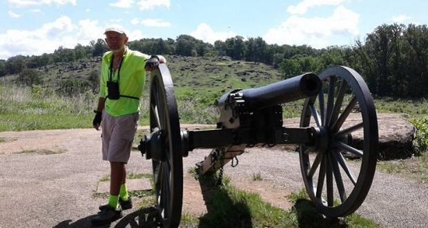
The Battle of Gettysburg was the largest land battle ever fought in the western hemisphere.
Led by General Robert E. Lee in the spring of 1863, the Army of Northern Virginia invaded the north with the intention of threatening Washington, D.C.
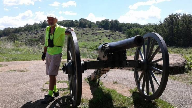
I’m standing at Union gun emplacements that were overrun by the Confederates who then were decimated in their attempts to attack the Union left flank at Little Round Top, behind me. Many hundreds died within the frame of this picture.
The Army of the Potomac, under General George Meade, shadowed them to the east in order to screen the capitol. Neither side had intended to fight at Gettysburg but, within 36 hours of a chance encounter between patrols west of the town, nearly 200,000 troops and 650 artillery pieces had converged on the small town.
The battle occurred over three days from July 1-3 and ended with a decisive Union victory that permanently ended the South’s offensive capabilities.
There were nearly 60,000 casualties. Though the war continued for nearly two more years, its outcome was effectively determined on the battlefield at Gettysburg.
On the third day of the battle, after failing on the Union left and right flanks, Lee decided on a direct assault on the center of the Union line at a 90-degree angle in the rock wall, near the tree on the right in this battlefield photo.
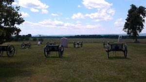
The ultimate effect of what happened in the half acre of land shown in the foreground was a change in a verb.
Around 1 p.m. on July 3, about 200 Confederate guns, positioned in the trees in the background, opened fire on the Union lines.
The fire continued for about two hours in what was the largest artillery exchange ever seen in the Western Hemisphere. At about 3 p.m., the artillery fell silent and 13,000 Confederate troops emerged from the trees in the background, three-quarters of a mile away, and began a rapid advance toward the Union line in what has come to be known as “Pickett’s Charge.”
The Union held its fire until the Confederates were only a few hundred yards away, and then opened up with withering small arms and artillery fire.
The Confederates broke into a run and topped the Union lines at the low rock wall in the foreground.
Hand to hand combat, bayonet duels and point blank artillery fire ensued. After a short. time the Confederates were repulsed and the next day they began their retreat back to Virginia, never again to mount a major offensive.
This small piece of land has become known as the “High Water Mark of the Confederacy” and represents, strategically, geographically and symbolically, the closest the Confederacy came to attaining its goals.
Before the Civil War people would say things like, “What are the United States going to do?”
After the Civil War they would instead say, “What is the United States going to do?”
That slight but significant change in language, representing a huge conceptual shift, can be said to have occurred on the small piece of land shown in this picture.
 Commercialization of the battlefield began almost immediately, with sightseeing tours arriving only days later to camp amongst the freshly dug graves and rotting corpses of thousands of horses and mules.
Today, we tend to view this with some disdain, but wanting to see is a fundamentally human thing and I suppose it’s the reason I’m on this trip.
The correct balance between commercial access and historical reverence remains an issue to this day. It’s depressing, though, to see young people videoing themselves twerk dancing and taking crazy-face selfies on ground where people, about the same age as themselves, were once blown to bits. Bits that still, and will forever, remain in the land.

A seven-foot rat snake I saw crawling across the road near White Sulphur Springs, West Virginia. Fortunately, I was able to find a stick to poke at it before it crawled away. It wasn’t amused. Surprisingly fast, it would strike about 18-inches and then move forward and strike again. Sure kept me movin’.
From Gettsyburg, the route travels north and then east through Pennsylvannia, New York, New Jersey, Connecticut, Rhode Island and to my final destination in Massachusetts. The weather is still problematic but I’m feeling stronger, the terrain easier, and the states smaller.