Almost a year ago, the Tioga Pass was still open and we could access a winter wonderland in the high country. The Tioga Pass is closed for the winter now, but I am revisiting another one of those hikes we made in December 2011 from the old ghost town and mining community of Bennettville, passing by frozen lakes and waterfalls to Spuller Lake to the north.
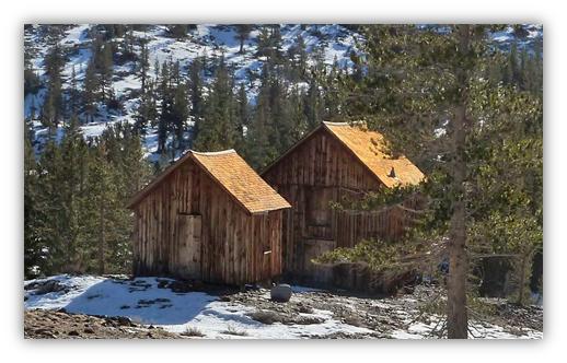
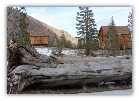
Where: Inyo National Forest Highlights: Lots of frozen things! Streams were frozen solid. Waterfalls were frozen in time. Lakes that were frozen in the morning had a slight gleam to them in the afternoon as they slightly melted on top, creating beautiful reflections. Oh, and we can’t miss the opportunity to visit the ghost town of Bennettville. Sally, my Weimaraner who was about 9 months old at the time of this hike, just loves camping, backpacking, hiking and fishing with me. Well, she isn’t too wild about the fishing part. That is just too boring. Starting our adventure at the parking lot at the Tioga Junction Meadow Campground, 2.2 miles east of the Tioga Pass entrance to Yosemite National Park, we headed up the trail that goes through the campground. The trail wanders alone Mine Creek as you head toward Bennettville. When you reach the two restored old wooden buildings, all that remain of 14 buildings, you can’t help but imagine what this once bustling mining area was like back in it’s hey day. The United States Forest Service restored the two buildings, an assay office and a bunkhouse, back in 1993.
The Great Sierra Mining Company was formed and the town site was called Bennettville, after Thomas Bennett Jr., the president of the mining company. A post office was opened in 1882 and a telegraph line was strung from Lundy. Surveying began for a proposed 56 mile road from the west from Crocker’s Station near what is now Big Oak Flat. The road was to be called the Great Sierra Wagon Road.
The Great Sierra Mining Company worked a 1,784′ deep tunnel in search of silver. Unfortunately the company ran into financial problems and shut down July 3, 1884. The post office closed in November of that year. In 1889, a new company called The Great Sierra Consolidated Silver Company started working the old tunnel, drilling an additional 216 feet. None of that valuable ore was found and work quit on the mine again. There are several attempts over With the advent of the automobile and the need for roads to drive them on, the National Park Service purchased the Great Sierra Wagon Road in 1915. The road was improved to allow automobiles to travel on it and is now known as the Tioga Road.
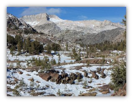
Onward on our adventure, we continued up the trail, following frozen Mine Creek with a great big view of Mt. Conness in front of us to the north.
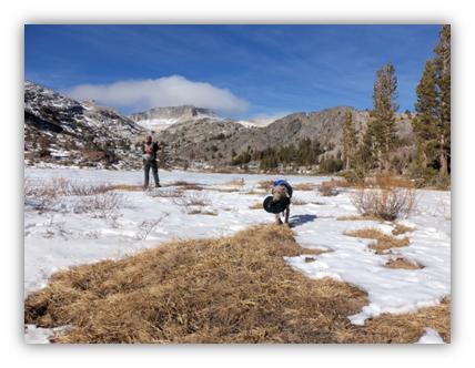
While my hiking partner stopped to take a picture of ice covered Shell Lake, he had apparently lost his hat. No worries. Sally retrieved it and brought it to me, showing off her great find!
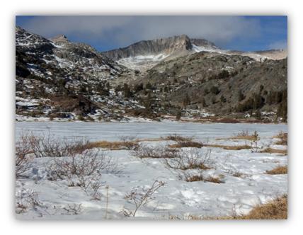
More of Shell Lake.
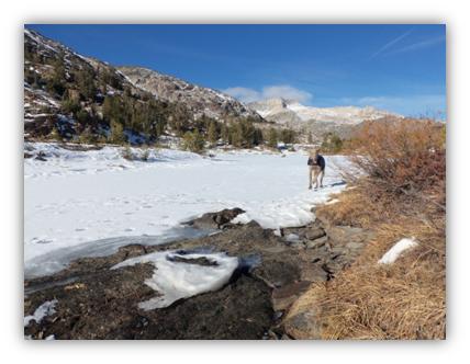
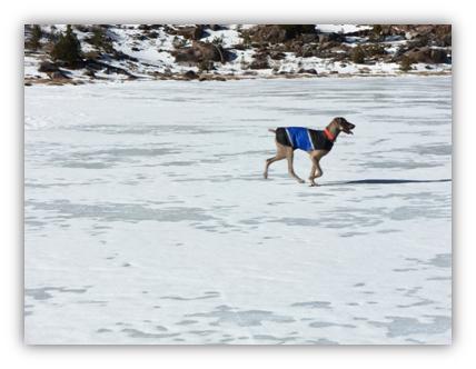
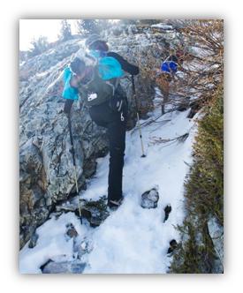
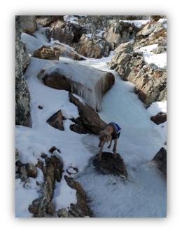
Sally and I work our way up the icy hill. Photo by Keith Sauer.
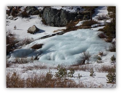
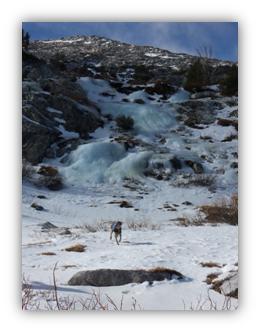
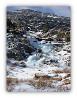
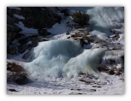
Frozen waterfalls above Fantail Lake.
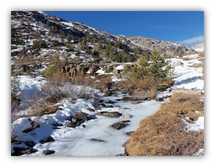
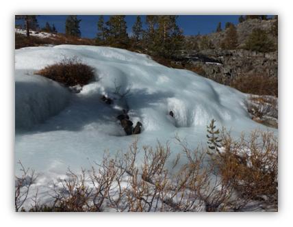
Frozen streams.
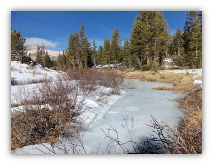
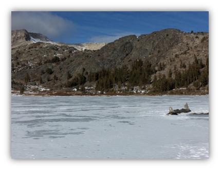
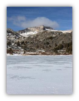
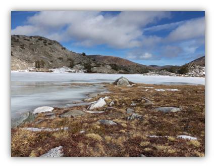
Frozen Lakes
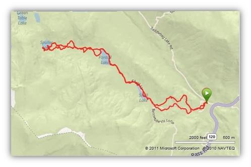
Distance: 6.14 Miles
Elevation Range: 9,534-10,290′
Date: December 28, 2011
 The story goes that in the 1870’s a shepherd boy located a ledge near the east side of the summit of Tioga Pass but it wasn’t until 1877 that new samples from the area prove that this mine could be worthwhile. As the mine in Aurora was playing out, the unemployed miners began prospecting the Bennettville area and the Tioga Mining District was soon formed.
 the years to rework the mine but no ore of value was located in these small attempts. Work also ceased on the Great Sierra Wagon Road.