
EASTERN MADERA COUNTY – After days of listening to the radio traffic on the Aspen Fire, I decided to take a drive up the mountain and see for myself what it looks like from the west side of the river.
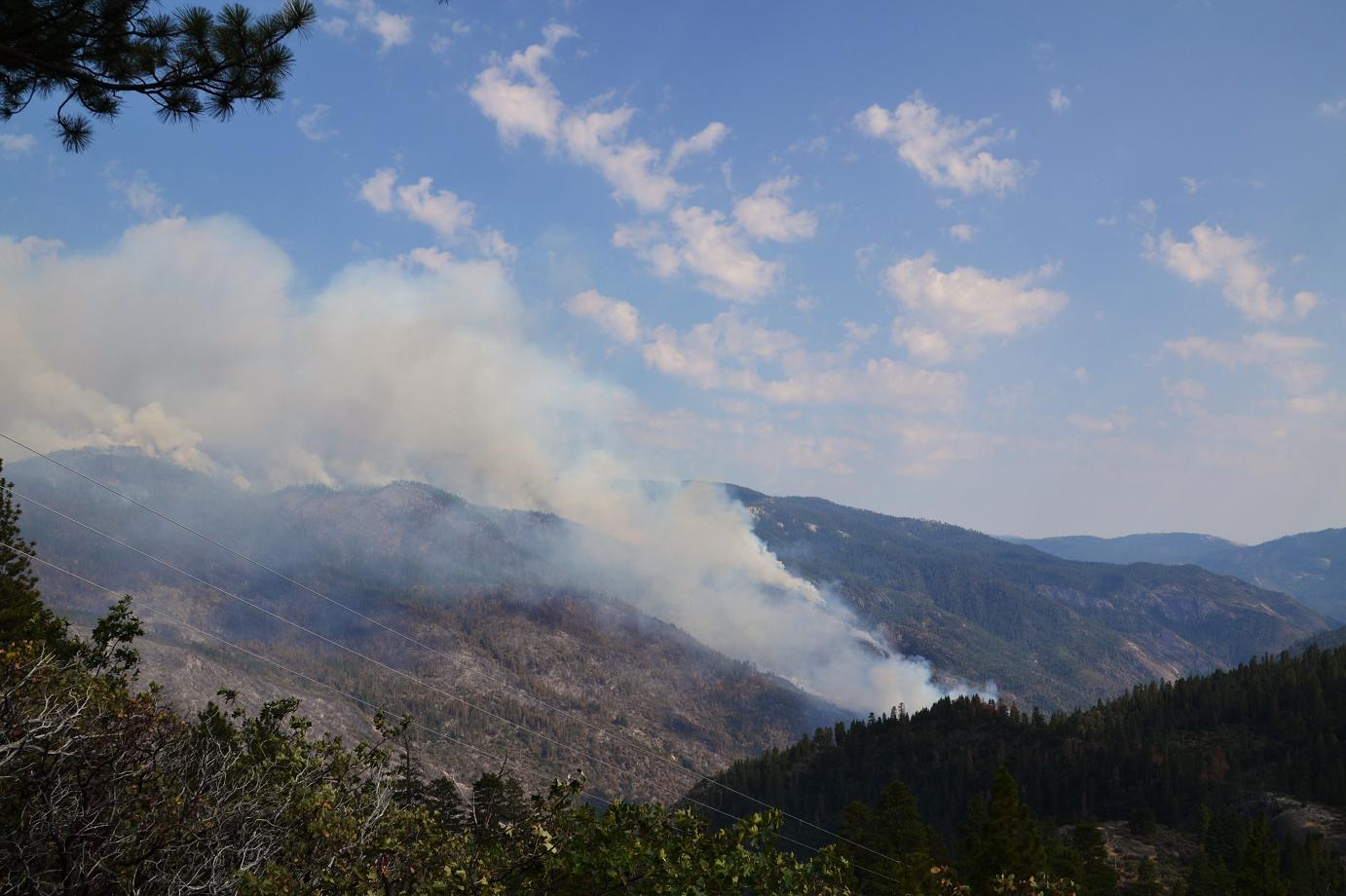
The fire is now 11,019 acres, and 20% contained. The total containment date has been pushed out to Aug. 10. Best news – it has not crossed the river. (click photos to enlarge)
 The first thing I noticed on my journey was the lack of smoke along the way. It was about 3 p.m. when I left North Fork, and the skies were surprisingly clear all along Mammoth Pool Road (4S81).
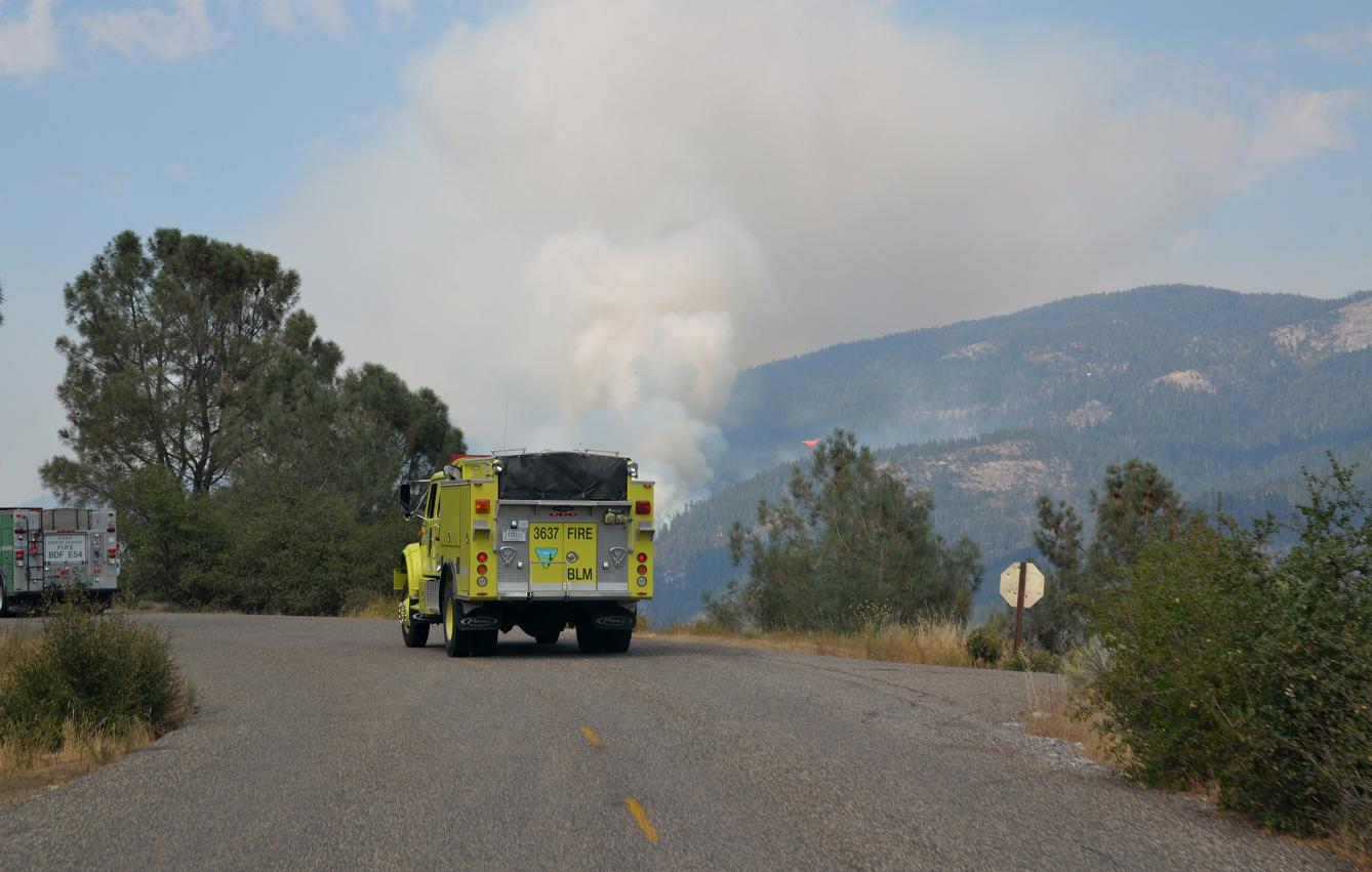
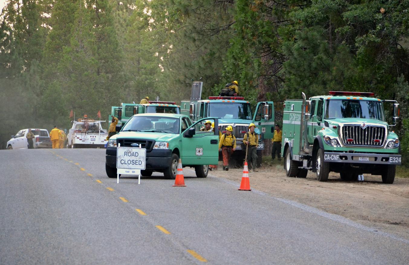
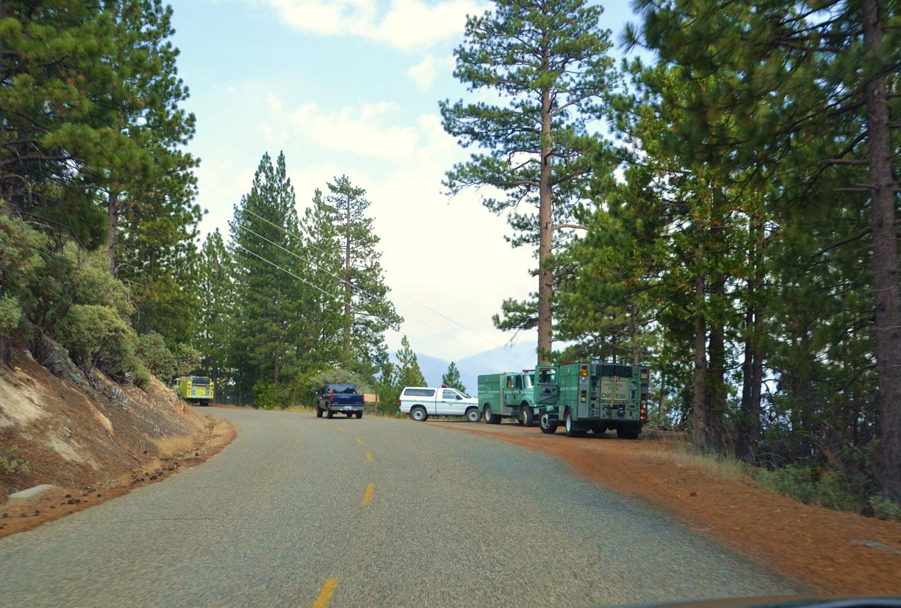
I followed a line of four engines from various regions headed up to join the dozens of others now dispatched to the area all along 4S81. Total personnel on the fire has grown to 1,479.
The crews and equipment on the west side of the San Joaquin River canyon have been put in place to be ready in the event that the fire crosses to the Madera County side.
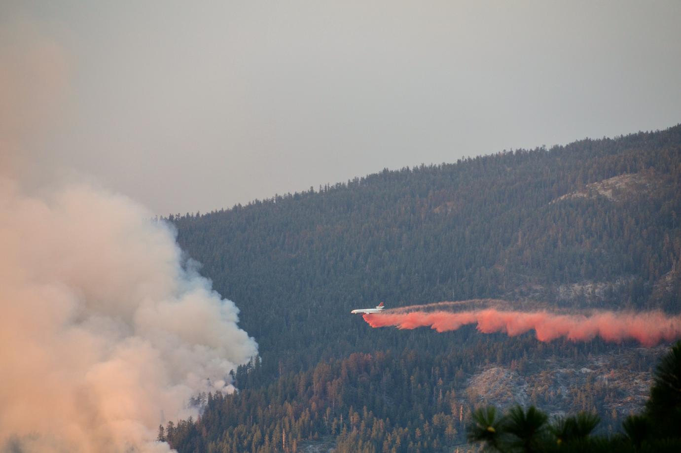
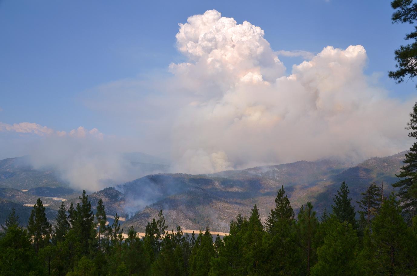
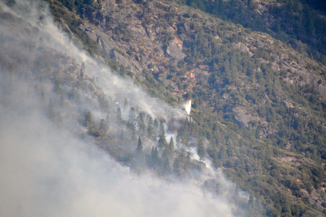
There was a clear view of the fire just below Clearwater Ranger station, and several people were parked there taking pictures of the air tankers dropping retardant along the southern edge.
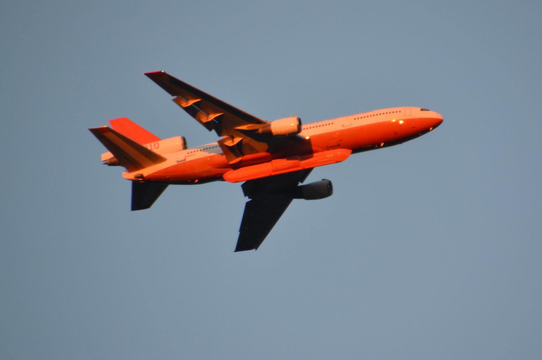
This massive former-airliner, a Very Large Air Tanker (VLAT)- DC-10, was really amazing to watch. It was so big, it appeared to be barely moving through the sky, as though the speed wouldn’t allow it to stay airborne.
It made two passes to drop retardant along the southern edge of the fire, and then lumbered off, headed southwest.
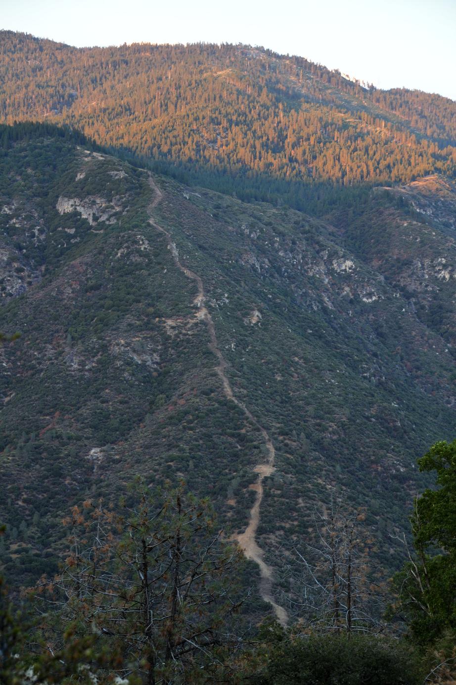
An old dozer line was clear along a ridge across the canyon, but was a long way from the flames of the Aspen fire.
 A mile or two north of the Hogue Ranch, the road has been closed, and from there on, pink ribbons were strung across roads and campground entrances. Everyone was evacuated from Fish Creek north on Thursday, July 25, and seeing all those empty campsites at the height of the summer season was a bit surreal. Made me want to stop and enjoy the peace and quiet, and maybe dip a toe in the creek.
 Wherever there was a clear view of the canyon, there were fire personnel stationed, keeping an eye on the forest and watching for any sign that the fire had spotted across the river. With gusty winds blowing in from the south-southwest, everything was moving away from us and keeping the smoke on the east side.
Those winds are a double-edged sword, however. They clear out the smoke and allow aircraft to do their job, but they also cause an increase in fire activity.
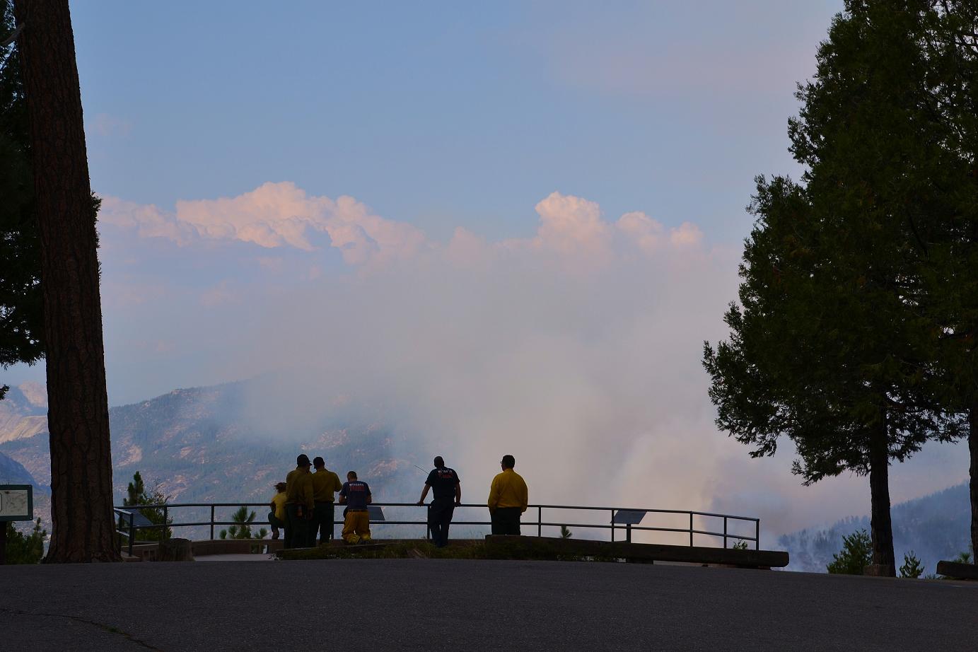
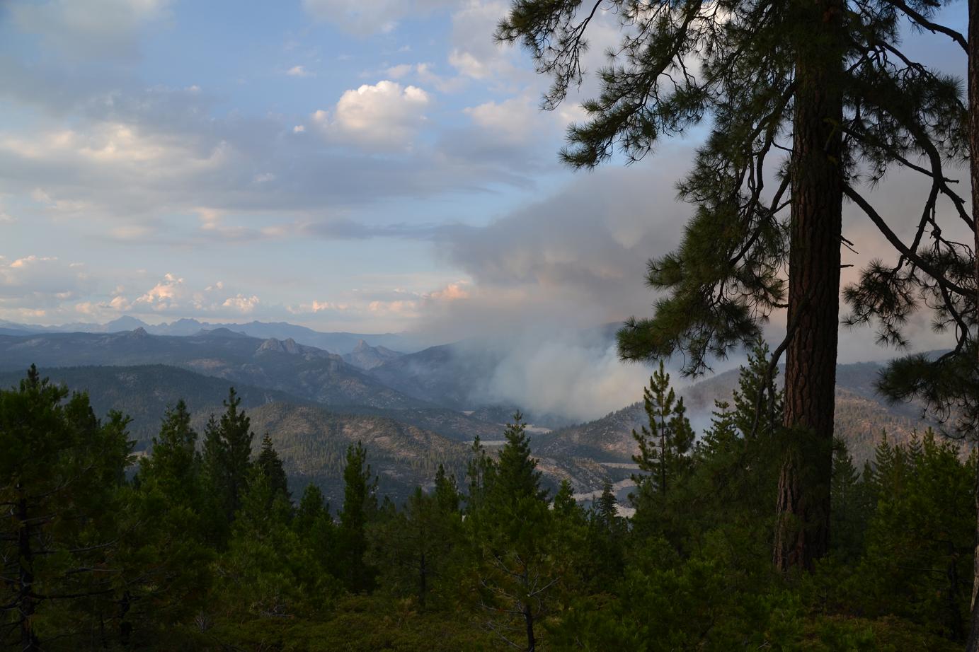
At Mile High Vista Point, I visited with a crew from El Dorado, and another from the Bureau of Land Management. They seemed rather happy to have been assigned duty on the west side, as opposed to the Hot Shot crews and others who are working in the harsh, steep terrain on the other side of the canyon.
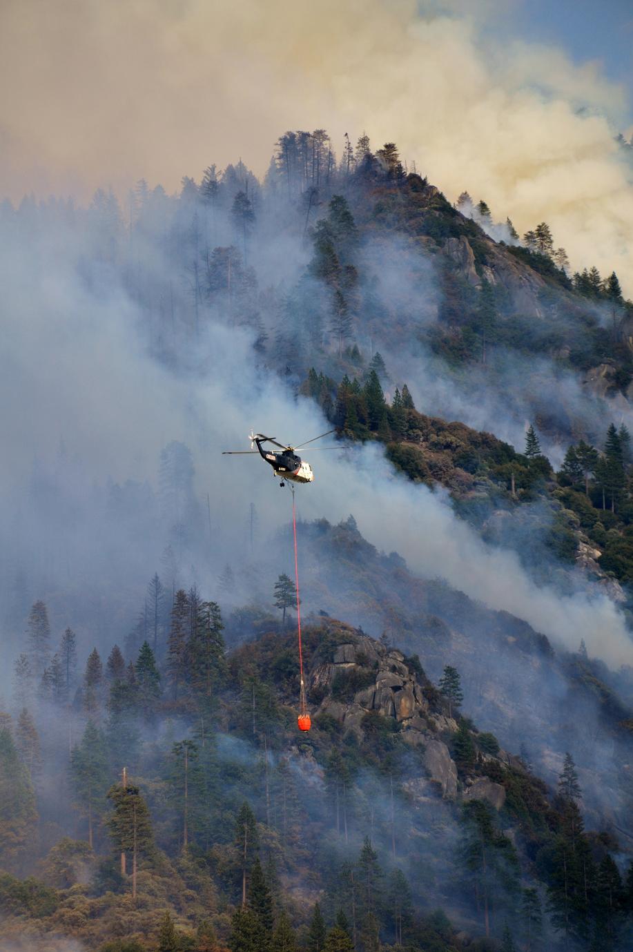
These folks were keeping watch from the Vista, and with the smoke blowing away to the northeast, they had a spectacular view of the lake, the fire and the air show put on by some of the 10 helicopters and 4 fixed wing aircraft working across the river.
There is a spike camp set up at Minarets Work Station, and I passed about six engines headed up that way as I drove back down to Rock Creek.
 At the Rock Creek campground, I turned in and headed down the long, narrow and winding road that follows the creek down toward the San Joaquin River.
There were crews stationed at various points along the road, watching the fire for any signs of it crossing the canyon.
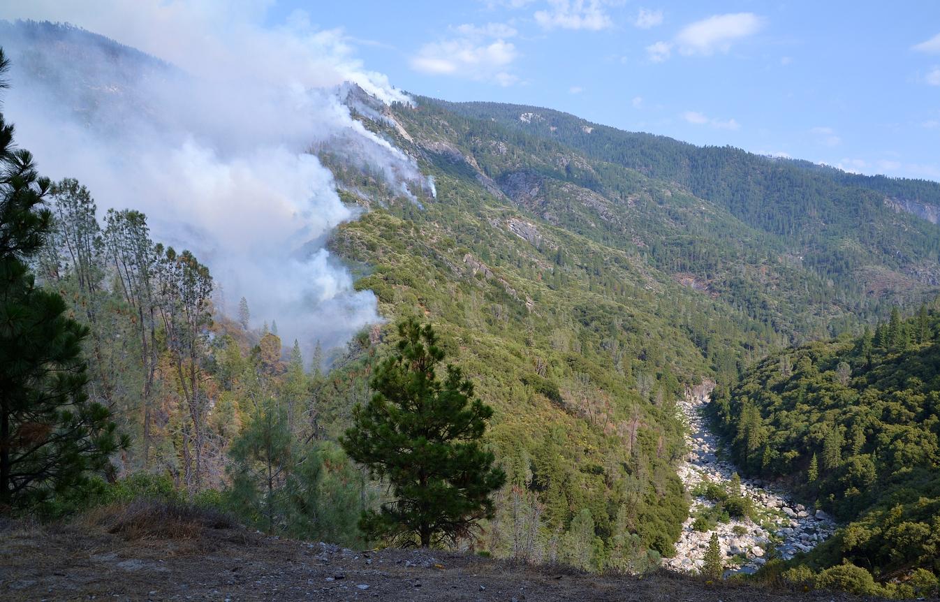
At the bottom of the road, I was still a good distance above the river, looking down over a very steep dropoff.
There was a good view of the river bed, mostly devoid of water but enough for the helicopters to fill bladders and douse the fire on the other side.
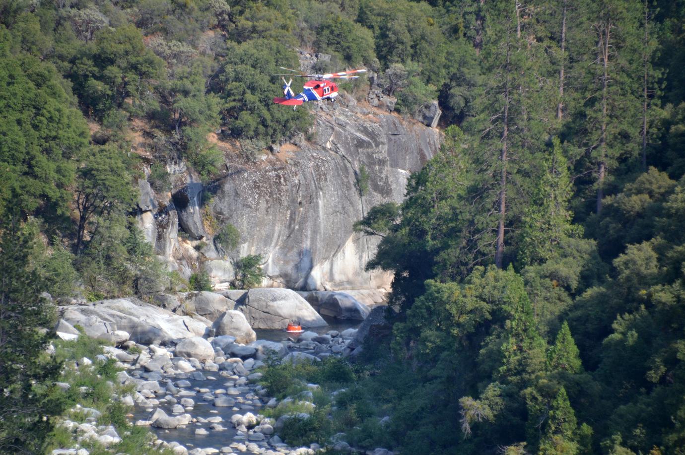
The larger of the two ships was picking up water from Mammoth Pool, but the other, with amazing skills from the pilot, was dealing with gusty winds and tight quarters, dipping out of a pool in the river.
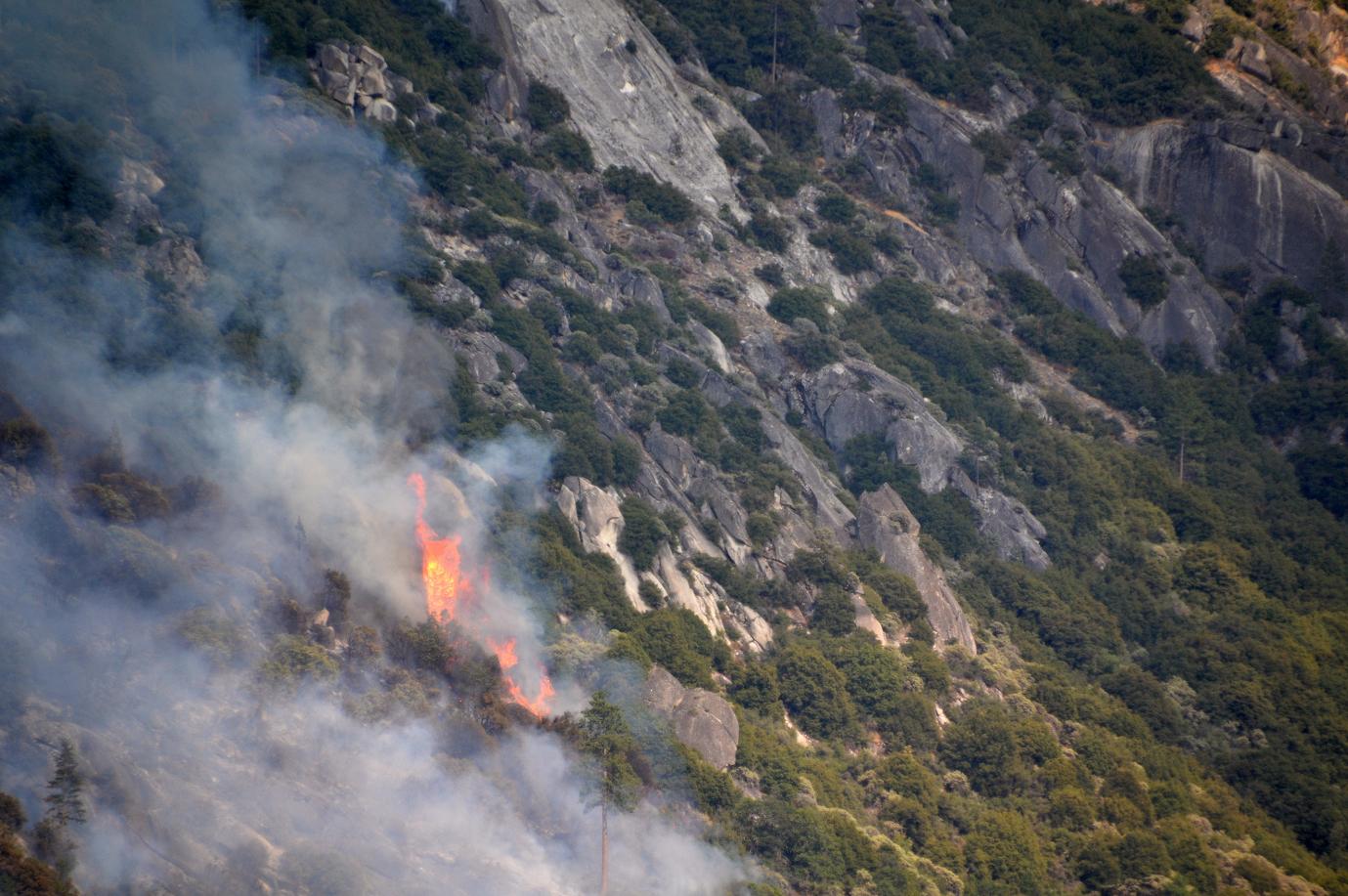
It’s difficult to appreciate just how steep and rugged this terrain is until you see it up close and personal. Anyone wondering at the amount of time it is taking to cut a line around this fire can see from the photos that much of it is sheer granite, and no place for man, woman or bulldozer.
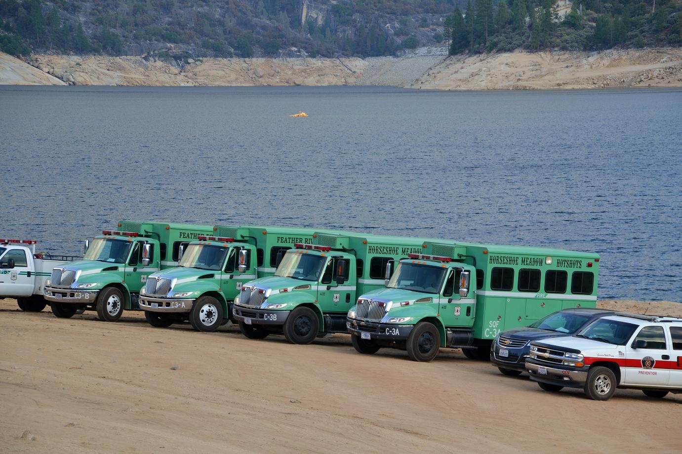
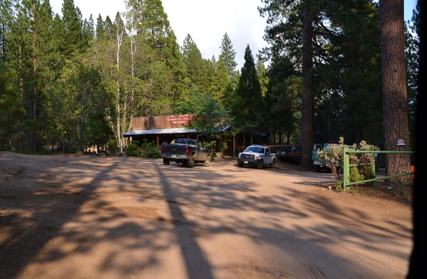 My next stop was Mammoth Pool, driving by Wagner’s Store on the way. It was eerily quiet, with only the fire crews in the area. The campgrounds were deserted, but the beach at the boat launch was lined with Hot Shot vehicles, and the firefighters are ferried across the reservoir every day to work the fire lines.
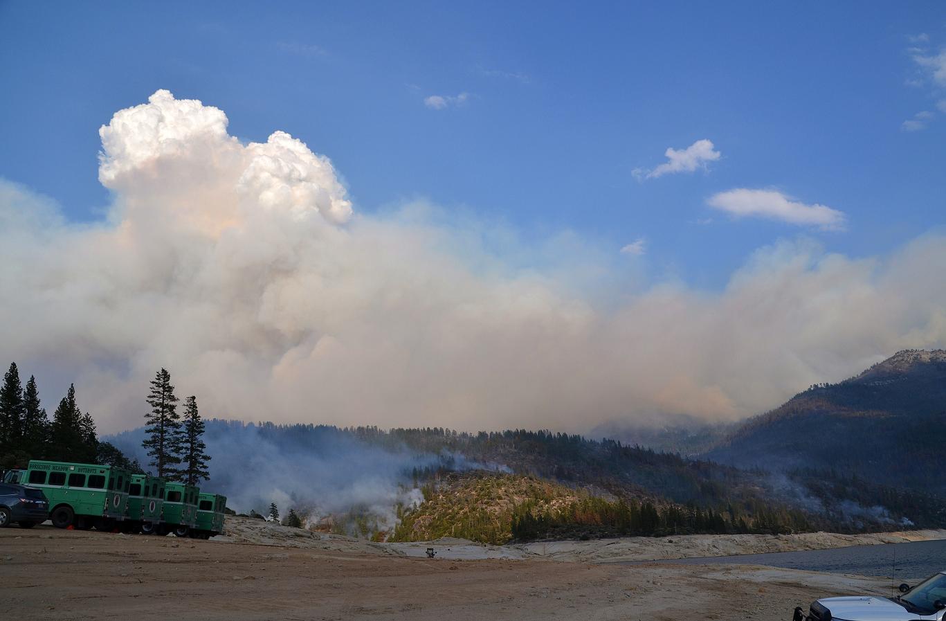
There are currently Hot Shot crews from Mad River, Kings River, Horseshoe Meadow, Feather River, Diamond Mountain, El Dorado, Dalton, Calaveras Wildland, and a Sierra Strike Team.
 Fire officials report that good progress has been made with indirect line on the northwest side of the fire, and indirect line has been completed on the southwest side.
Indirect attack is accomplished by building a fireline some distance from the fire’s edge and backfiring the unburned fuel between the fireline and the edge of the fire.
Crews continue to use direct attack when possible. Access to the lower portions of the fire along the San Joaquin River’s edge is an obstacle, and smoke from the fire continues to impact the mountain area and the San Joaquin Valley.
The cost to fight this fire is about $5.7 million so far.
 Thanks to all our firefighters, and to all the families who miss them .
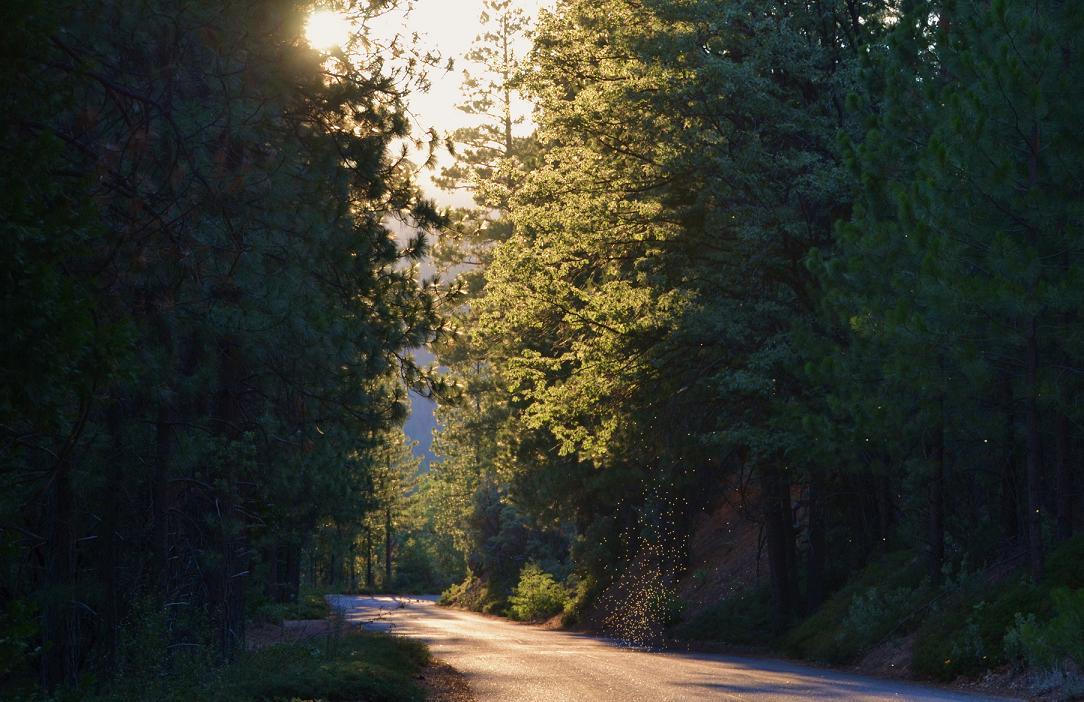
(I took this photo on the way home, of a swarm of bugs in the sunlight. Just for fun!)


Thank you, Gina – very informative with great photos.
Great report. It is nice to know the fire hasn’t crossed the river. The pictures are excellent. I liked the one of the bugs!
great reporting and pictures! the photo of the hell dipping water out of the rocky river be is spectacular! and thru these pix we can truly see the rough terrain the firefighters must deal with.
bless them all with a safe return!
Our son and his wife work at the Wagner Store and we live in Ohio. I have been glued to the Internet looking for ANY information. While many sites give accurate information your article gave me just what I was looking for…reassurance that is he and my daughter-in-law are safe. Thanks for your wonderful article AND the picture of the store.